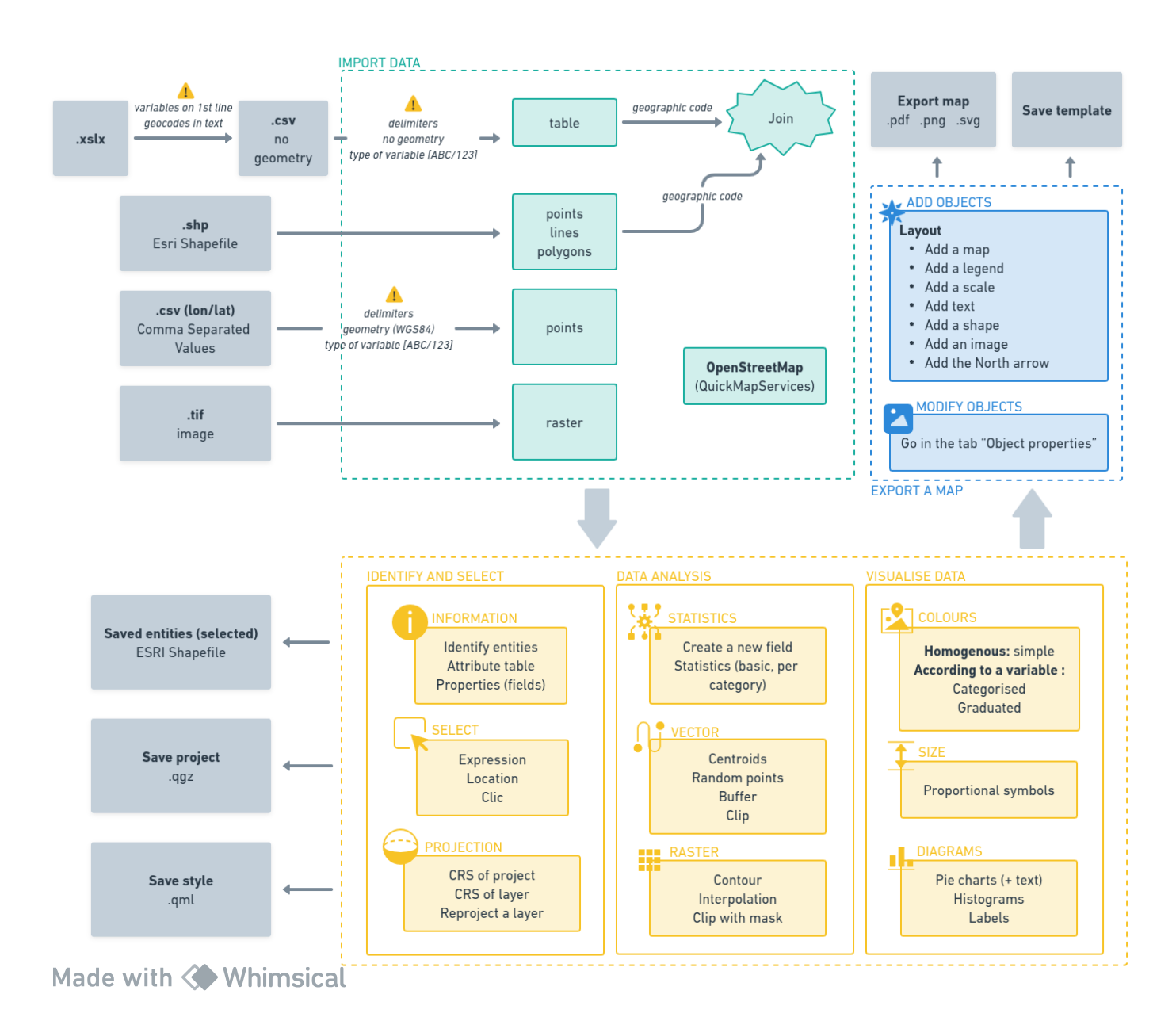
The GIS module introduces students to the analysis of geographic information, enabling them to carry out a pre-diagnosis of the agricultural, economic and socio-demographic dynamics of a rural area. Through the elaboration of thematic maps, it shows how to communicate complex information to help manage territories. Below is a diagram showing all the basic steps that you will learn. It is a useful tool for quickly checking if you acquired the required skills to use GIS.
Install the latest version of QGIS by following this link: https://www.qgis.org/en/site/forusers/download.html.
When you have installed QGIS, go through the Introduction to familiarise yourself with QGIS interface.
Once this is done, you can go on to the tutorial, which has four main parts:
- Getting to grips with QGIS
- Introduction to geoprocessing
- Representation
- Layout